


National Weather Service Forecast for: Orlando, Florida Forecast Details


725
FXUS62 KMLB 251900
AFDMLB
Area Forecast Discussion
National Weather Service Melbourne FL
300 PM EDT Sat Jul 25 2026
...New KEY MESSAGES, DISCUSSION, MARINE...
.KEY MESSAGES...
Issued at 300 PM EDT Sat Jul 25 2026
- Gradually increasing moisture through the weekend and early next
week will allow rain chances to slowly return to near and
above normal values.
- Highs in the low to mid 90s will continue, with peak heat
indices reaching 102-107F each afternoon, and potentially
nearing Heat Advisory criteria (108-110F) for portions of the
area this weekend and into early next week.
&&
.DISCUSSION...
Issued at 300 PM EDT Sat Jul 25 2026
Through Tonight...Scattered showers and storms have developed
across areas south of Orlando this afternoon, with the east coast
sea breeze just barely pushing past I-95. These storms are already
producing frequent lightning strikes. Activity is anticipated to
continue developing through the remainder of this afternoon, with
the highest coverage anticipated to remain south of Orlando. The
environment remains favorable for some isolated stronger storms,
with frequent lightning strikes, wind gusts up to 50 mph, and
heavy downpours remaining the primary concerns. Weak westerly
winds aloft will lead to slow and erratic storm motions, increasing
the threat for localized flooding in any spots that see repeated
rounds of slow-moving activity. Showers and storms are forecast
to gradually diminish across the peninsula beyond 10 PM, though
some light, isolated development across the local Atlantic waters
(especially the Gulf Stream waters) cannot be ruled out overnight.
Temperatures across east central Florida remain on track to reach
the low to upper 90s this afternoon, with the warmest
temperatures anticipated near and north of the I-4 corridor. A
Heat Advisory remains in effect through 7 PM across Lake, Orange,
Seminole, Volusia, and Brevard counties for peak heat indices of
108-110F. Overnight lows remain in the 70s.
Sunday...Broad, weak ridging will remain in place aloft and at
the surface, keeping southwesterly winds generally light locally.
The east coast sea breeze is forecast to develop, though west to
northwest winds aloft will keep it pinned closer to the coast and
result in greater coverage of showers and storms across the
eastern portion of the peninsula. Shower and storm development
will be further supported by a wave of energy aloft pushing
southward across Florida during the afternoon hours, with PoPs
ranging between 50-70% areawide. Frequent lightning strikes and
wind gusts up to 55 mph will be possible with any storms that
manage to develop thanks to the energy aloft and a pocket of drier
air above 700 mb. Additionally, with PWATs exceeding 2.1"
areawide, heavy downpours are forecast with activity, and
localized flooding cannot be ruled out. All of east central
Florida is included within a Marginal Risk (1/4) of excessive
rainfall on Sunday, with quick rainfall accumulations of 2-4"
possible. Aided by the west to northwest flow aloft, showers and
storms are forecast to move offshore through the evening and
overnight hours, with activity gradually diminishing across the
peninsula through the overnight hours.
Temperatures on Sunday are forecast to range from the low 90s
across the Treasure Coast and near Lake Okeechobee into the mid to
upper 90s elsewhere, with the warmest temperatures focused near
and north of the I-4 corridor. Peak heat indices ranging from
102-107F are anticipated areawide, with some spots across the
north potentially exceeding 108F once again. Opted to wait and see
if trends hold, and if so, would not be surprised to see another
Heat Advisory needed for northern portions of east central
Florida. Residents and visitors planning to spend extended periods
of time outdoors tomorrow will need to remain adequately hydrated
and take frequent breaks in the shade or air conditioning in
order to avoid developing heat-related illness. Muggy conditions
will continue into the overnight hours, with lows in the mid to
upper 70s.
Monday-Friday...Broad ridging aloft centered across Texas and the
Four Corners region will remain in place through Tuesday, with
its eastern ridge axis stretching towards the Florida peninsula.
At the surface, broad, weak high pressure situated across the Gulf
and Atlantic waters will lead to continued offshore flow locally.
Plentiful moisture, a developing east coast sea breeze, and some
pulses of energy aloft will support convective development each
afternoon across east central Florida. Coverage of showers and
storms remains high at this time. By mid week, the pattern begins
to shift slightly. Troughing across the eastern US will strengthen
and extend southward, with 500 mb heights falling mid to late
week as the mid-level ridge gets kicked westward. At the surface,
the trough aloft will help push a decaying surface boundary
southward towards the Florida peninsula, resulting in another
surge of moisture as well as a tightening pressure gradient. Some
guidance suggests this boundary will stall across the peninsula,
slowly shifting south through late week. Southwesterly winds are
anticipated to increase locally, resulting in less of a chance for
the east coast sea breeze to develop. Regardless, the energy
aloft from the strengthening trough along with the plume of
moisture will still support scattered to numerous shower and storm
development each afternoon across the Florida peninsula. Overall
storm hazards look to remain fairly consistent each day, with
lightning strikes, strong wind gusts, and heavy downpours all
possible. This will be an active week, so flooding will also
be a concern as the soils become further saturated by repeated
rounds of rainfall. Showers and storms are anticipated to follow a
general diurnal pattern Monday and Tuesday, with activity pushing
offshore during the late evening and overnight hours across the
local Atlantic waters. Wednesday onward, there is a chance for
some lingering activity across northern portions of the area where
the frontal boundary stalls. Trends in where the boundary stalls
will influence this, so will continue to monitor.
Temperatures are forecast to remain near to slightly above normal
through at least Wednesday, reaching the mid 90s in spots.
Widespread peak heat indices of 102-107F are forecast, with some
locations potentially exceeding Heat Advisory criteria. This will
continue to be monitored closely, and proper heat products will be
issued as needed. The increasing moisture and resulting
increasing cloud coverage and rain/storm chances will keep
temperatures closer to normal Thursday and Friday, though muggy
conditions will keep peak heat indices of 102-107F across east
central Florida. Lower confidence in reaching Heat Advisory
criteria Thursday onward, but regardless, heat safety will still
be key for residents and visitors of the east central Florida
area. Adequate hydration, frequent breaks in the shade or air
conditioning, and dressing in lightweight, lightly colored
clothing if spending extended periods of time outdoors will help
reduce the chance of developing heat illness next week.
&&
.MARINE...
Issued at 300 PM EDT Sat Jul 25 2026
Broad high pressure is forecast to remain situated across the
local Atlantic waters through mid week, keeping boating conditions
generally favorable through Tuesday. Southwesterly winds ranging
from 5 to 15 knots are forecast, with the highest winds forecast
in the afternoon and evening hours. Seas of 2 to 4 feet are
anticipated. Isolated to scattered offshore-moving showers and
storms will be possible, particularly during the late afternoon
and into the overnight hours. Lightning strikes, wind gusts in
excess of 34 knots, and heavy downpours will be possible with any
storms that develop.
Wednesday onward, the pattern shifts as a boundary drifts
southward towards the Florida peninsula and the local waters. A
tightening pressure gradient will result in increasing offshore
winds to 15 to 20 knots, with some spots across the offshore
waters exceeding 20 knots. Seas gradually build, reaching 4-5 feet
across the offshore waters Wednesday through Thursday. The
boundary will result in increasing moisture, with higher rain and
storm chances forecast across the waters through late week. Storm
hazards will remain the same.
&&
.AVIATION...
(18Z TAFs)
Issued at 102 PM EDT Sat Jul 25 2026
Already have a few showers and storms developing near our Treasure
Coast terminals this afternoon. Focus should shift west of those
terminals after 21Z, with some increase in convective potential
near MCO closer to that time and through sunset. Light winds
today, bcmg ESE at the coastal sites up to 12 KT. Quiet conds
expected overnight.
Much greater coverage of showers and storms are expected on Sunday
afternoon. TEMPOs will be required in later updates.
&&
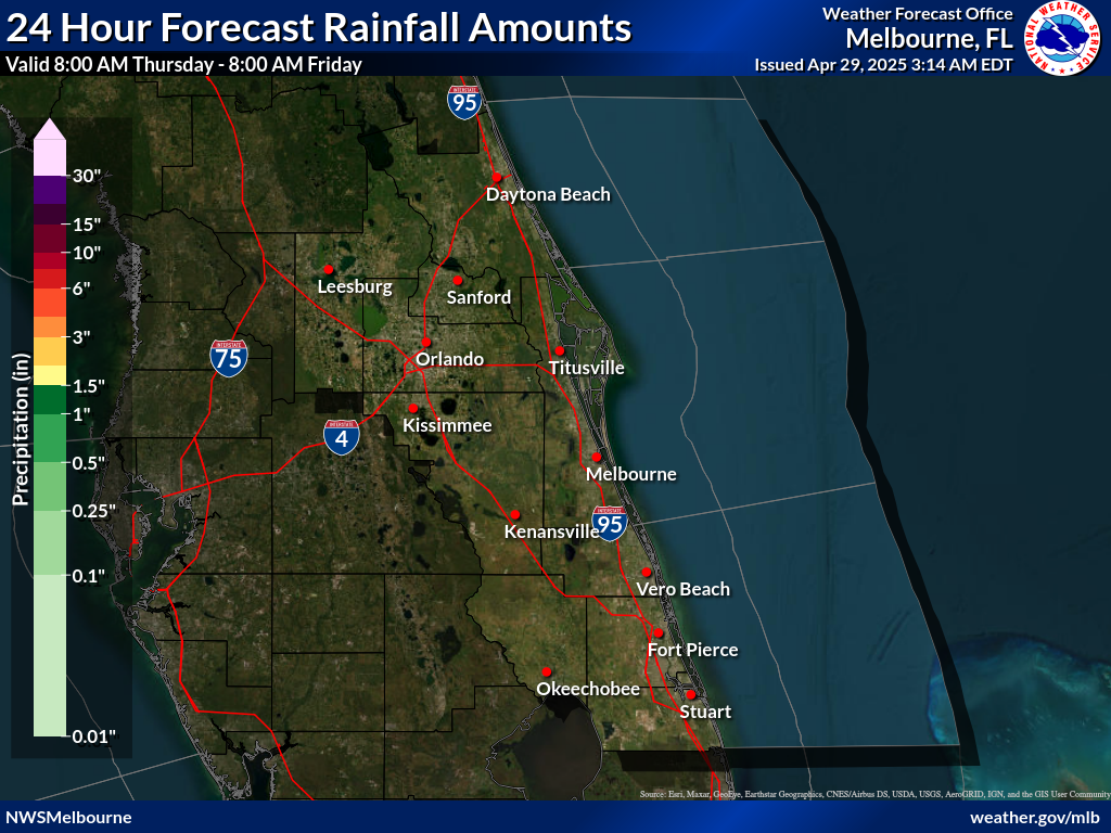
.PRELIMINARY POINT TEMPS/POPS...
DAB 77 94 76 92 / 10 60 40 70
MCO 78 96 77 94 / 20 70 30 70
MLB 76 92 76 92 / 10 60 30 70
VRB 74 93 75 93 / 10 50 20 60
LEE 79 94 79 93 / 20 50 30 70
SFB 79 95 78 93 / 20 60 30 70
ORL 79 95 78 93 / 20 70 30 70
FPR 74 92 74 92 / 10 60 20 60
&&
.MLB WATCHES/WARNINGS/ADVISORIES...
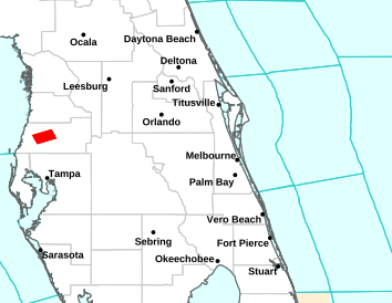
FL...Heat Advisory until 7 PM EDT this evening for FLZ041-044>046-141-
144-247-347-447-547-647-747.
AM...None.
&&
$$
DISCUSSION...Tollefsen
AVIATION...Heil
National Weather Service Forecast for: Miami, Florida
| This Afternoon  T-storms Likely |
Tonight Scattered T-storms then Partly Cloudy |
Sunday Sunny then T-storms |
Sunday Night T-storms Likely |
Monday Scattered T-storms then T-storms Likely |
| Hi 89 °F | Lo 81 °F | Hi 90 °F | Lo 80 °F | Hi 89 °F |
National Weather Service Forecast for: Miami, Florida Forecast Details


Contact © 2024, WeatherFL.com