


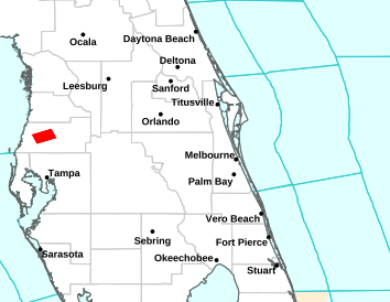


National Weather Service Forecast for: Orlando, Florida Forecast Details


173
FXUS62 KMLB 021812
AFDMLB

Area Forecast Discussion
National Weather Service Melbourne FL
212 PM EDT Sun Aug 2 2026

...New KEY MESSAGES, DISCUSSION, MARINE...

.KEY MESSAGES...
Issued at 211 PM EDT Sun Aug 2 2026

- Rain and lightning storm chances remain high through at least
  Monday (70 to 80%). The strongest storms will be capable of
  producing wind gusts from 50 to 55 mph.

- Localized flooding may result from repeated rounds of heavy rain
  and storms. There is a 5-10% chance of 2 to 4" amounts in less
  than 6 hours.

- Coverage of showers and storms will remain generally above
  normal this week, with the focus shifting toward the interior by
  midweek as the Atlantic sea breeze develops each afternoon.

&&

.DISCUSSION...
Issued at 211 PM EDT Sun Aug 2 2026

Rest of Today-Monday (Modified Previous Discussion)...Most of the
shortwave the developed over Florida this morning has pushed
offshore as it transits the sharp trough digging down the eastern US
to the Gulf and Florida, but lingering upper level energy in the
wake of this feature at the base of the trough is still streaming by
and could help support deep convection. Ridging extending from over
the Desert Southwest to the plains is expected to bifurcate the
trough, leaving a cut-off mid-level disturbance over the Deep South
while the rest of the trough over the Northeast US ejects towards
the Canadian Maritimes. The associated surface low will elongate and
lift into the eastern Great Lakes following the departing trough.
The attendant cold front front will be left trailing the low,
extending to the North Gulf Coast. Southwesterly flow in the low
levels increases across Florida as the pressure gradient tightens
between the front and high pressure over the Atlantic, which could
produce some wind gusts to 25 mph out side of storms. Moisture is
surging in the southwesterly flow, with PWATs ringing in at +2.2" on
GOES imagery and the morning soundings. However, confidence in
development of deep convection has reduced some this forecast
package. The band of showers and storms extending across North
Florida that was expected to drop southeast into our area is
struggling, likely due to lackluster destabilization from the
cloud cover. A line extending from South Florida to the Treasure
Coast and nearby Atlantic waters is doing better as it gradually
lifts north, but guidance screwiest the southwesterly flow will
help user this activity offshore before it pushes much farther
north than Vero or Melbourne. The most promising area for storm
development appears to be over Southwest Florida, with this
activity then pushing into our area. Reduced rain chances a bit in
the forecast due to the uncertainty, but they still generally
remain 50-70%. With the background winds increasing in the lowest
10 kft, storms may produce a few wind gusts of 50-55 mph. There is
also a very small chance for a severe storm, with wind gusts
around 60 mph.

A low chance of showers will persist through the overnight, then on
Monday, this rinse-and-repeat pattern should offer yet another round
of scattered-numerous showers and storms from late morning through
the afternoon. Once again, a few gusty storms are anticipated due to
somewhat enhanced winds aloft.

We will also be watching for occasional to frequent lightning
strikes and locally torrential rainfall where repeated bands of
storms occur. Storms should move progressively thanks to the
enhanced southwesterly steering flow, especially across the northern
portions of the area.  Slower storm motions would be favored near
Lake O to the Treasure Coast. Hi-res ensembles still suggest a 5-10%
chance of 6-hour rainfall tallies of 2-4"+, supporting a Marginal
Risk for excessive rainfall leading to localized flooding in poor
drainage areas across all East Central Florida.

High temps should range from the upper 80s to the low 90s, with
Monday the warmer of the next two days. Peak heat indices should
range from 98 to 106. Southwest winds will be breezy at times
outside of storms as well, from 15 to 25 mph.

Tuesday-Saturday (Modified Previous Discussion)...The grand ensemble
continues to signal a pattern transition by Tuesday, especially
Wednesday. As the trough fills and lifts away from Florida, mid-
level ridging is expected to expand westward over the W Atlantic.
Near-surface high pressure should lift northward, its axis near
Central Florida before shifting north of I-10 by Thursday. Offshore
flow will diminish on Tuesday afternoon and become onshore by
Wednesday. Each day, the Atlantic sea breeze should form. While it
may remain relatively close to the coast on Tuesday, it should reach
farther inland thereafter.

Guidance keeps total moisture values above normal on Tuesday before
it slightly decreases to near normal beginning Wednesday. All told,
storm chances will remain elevated for all areas on Tuesday
afternoon, 60-70%. Then by Wednesday and Thursday, more typical
storm coverage is anticipated, ranging from 40-60% along the coast
to 60-75% over the interior from Orlando southward.

Global ensembles continue to indicate that an inverted trough will
cross the Atlantic this week south of the Bermuda high, reaching
Florida by around Friday. Another surge of anomalous moisture is
forecast to accompany this feature late this week, perhaps lingering
into next weekend. Combined with onshore flow, enhanced coverage (60-
70%) of showers and storms is forecast, especially over the
interior. Whether this moisture surge comes over the state or is
deflected just to our northeast is still in question - and this will
help determine just how unsettled it gets late in the week.

&&

.MARINE...
Issued at 211 PM EDT Sun Aug 2 2026

(Modified Previous Discussion) A cold front settles into the
Southern Appalachians today, allowing southwesterly winds to freshen
over the local Atlantic, especially offshore Volusia tonight.
Scattered to numerous offshore-moving showers and storms are
forecast again today and on Monday. Then, high pressure begins to
lift northward, reaching Central Florida on Wednesday before pushing
even farther northward late in the work week. More typical sea
breeze conditions will return with this pattern change.

Today, south-southwest winds increase to 10-15 kt nearshore, and 15-
20 kt in the Gulf Stream off of Volusia Co, and the northernmost
Gulf Stream waters off the Space Coast, where small craft should
exercise caution. Winds turn more out of the south on Monday, 10-15
kt. By late Tuesday and into Wednesday, southeasterly flow is
favored, generally 10 kt or less with some enhancement behind the
sea breeze. Seas 2-3 ft in most locations through the next few days,
perhaps locally 4 feet late today and tonight well offshore of Ponce
Inlet.

&&

.AVIATION...
(18Z TAFs)
Issued at 125 PM EDT Sun Aug 2 2026

Lowering confidence surrounding shower and lightning storm potential
thru the aftn and early eve, due to extensive cloud-cover, lack or
radar returns already, and CAM guidance backing off on convection.
Strongest activity, should it develop, likely across the Treasure
Coast. Keep TEMPO groups in place for now, but realize they may not
occur or could be delayed - should convection finally get going.
Should the ECSB develop anywhere today it will remain pinned along
the (Treasure) coast, but could enhance storms locally as they move
off of the coast. Aside from frequent lightning and torrential
downpours, expect storms to be locally gusty again. Activity is
forecast to wind down after sunset, but could see ISOLD-WDLY SCT
convection lingering thru the evening, then mostly dry overnight.
For an early look into Mon, more of the same with persistent pattern
in place; SWRLY flow at the surface and for storm steering aloft.

&&

.PRELIMINARY POINT TEMPS/POPS...
DAB  74  89  74  89 /  30  50  20  70
MCO  75  90  75  90 /  30  50  20  70
MLB  75  90  75  89 /  20  60  20  60
VRB  73  90  73  89 /  20  60  30  60
LEE  75  88  75  89 /  40  60  30  60
SFB  75  90  75  91 /  30  50  20  70
ORL  76  90  75  90 /  30  50  20  70
FPR  73  89  73  88 /  30  60  30  60

&&

.MLB WATCHES/WARNINGS/ADVISORIES...
FL...None.
AM...None.
&&

$$

DISCUSSION...Haley
AVIATION...Sedlock
National Weather Service Forecast for: Miami, Florida
| This Afternoon  T-storms Likely |
Tonight Chance T-storms then Mostly Cloudy |
Monday Mostly Sunny then T-storms Likely |
Monday Night T-storms Likely then Slight Chance T-storms |
Tuesday Chance T-storms then T-storms |
| Hi 89 °F | Lo 82 °F | Hi 89 °F | Lo 82 °F | Hi 88 °F |
National Weather Service Forecast for: Miami, Florida Forecast Details


Contact © 2024, WeatherFL.com