


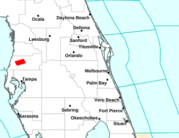


National Weather Service Forecast for: Orlando, Florida Forecast Details


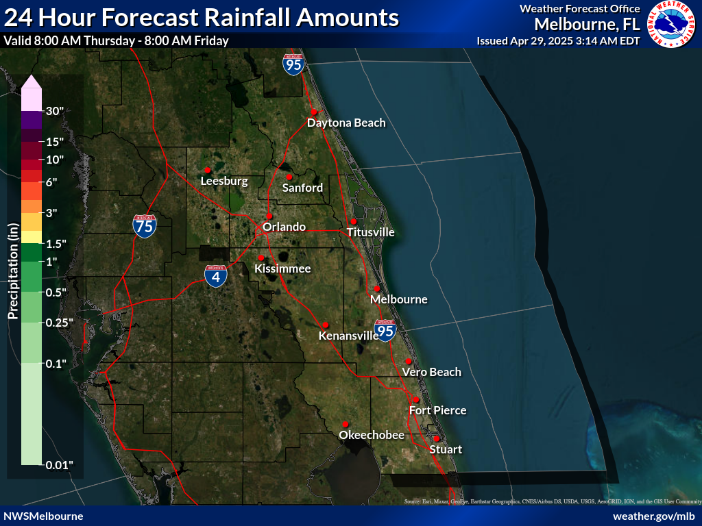
227
FXUS62 KMLB 100650
AFDMLB

Area Forecast Discussion
National Weather Service Melbourne FL
250 AM EDT Wed Jun 10 2026

...New KEY MESSAGES, DISCUSSION, MARINE...

.KEY MESSAGES...
Issued at 202 AM EDT Wed Jun 10 2026

- Building moisture will lead to increasing shower and storm
  chances each day. A strong storm or two cannot be ruled out in
  the afternoons and evenings.

- Increasing humidity will lead to heat index values of 100 to 105
  degrees or higher this weekend into next week; Moderate to Major
  HeatRisk is likely.

- At the beaches, a moderate risk of rip currents continues.
  Always swim near a lifeguard!

&&

.DISCUSSION...
Issued at 202 AM EDT Wed Jun 10 2026

Today-Tonight...Mid-level and surface high pressure drift offshore
from the Southeast US today. Locally, PWATs increase from 1.8 to
2". Already, more showers than previous mornings are present on
KMLB radar prior to sunrise. Expect this activity to continue
along the coast through the morning hours, especially along the
Treasure Coast. A few storms will be possible. Then, convection
moves inland this afternoon with the sea breeze, with a collision
west of Orlando. PoPs 20-50% today will be highest over the
interior and taper off through the day along the coast. Warm mid-
level temperatures will not favor strong storms. But, steep low-
level lapse rates and waterlogged updrafts could lead to a few
strong wind gusts. Slow moving storms amid nearly non-existent
steering flow will also lead to a locally heavy rainfall threat,
though drought still lingers across east central Florida. Highs
today reach the upper 80s along the coast and lower 90s inland.
Winds increase to 10-15 mph behind the sea breeze.

Lingering convection, driven by the sea breeze collision and
outflow boundaries, is expected this evening west of Orlando.
Expect PoPs to decrease through the evening hours, with drier
conditions prevailing by midnight. Some additional isolated to
scattered showers will be possible over the Atlantic waters, early
in the morning. But, CAMs suggest this activity will remain
largely offshore by daybreak. Overnight lows in the lower to
mid-70s.

Thursday-Friday...A weak surface ridge axis from the western
Atlantic drifts southward late week. Prevailing onshore flow comes
to an end Thursday, with light offshore flow developing on
Friday. However, will see a SE sea breeze develop at the coast in
the afternoons, regardless, increasing winds to 10-15 mph behind
it. Increased moisture and a progressively eastern sea breeze
collision will see building shower and storm chances through the
period. PoPs up to 50% will still remain generally west of I-95
Thursday, as morning showers stay mostly offshore. Then, PoPs
40-60% area-wide are expected for Friday. The threat for strong
storms will remain low, though a few cannot be ruled out. Steering
flow will remain weak overall, so locally heavy rainfall will
remain a threat. Any areas that see multiple days of heavy
rainfall over the same locations could develop a minor flooding
threat.

Temperatures increase late week, with highs reaching the lower to
mid-90s. Humid conditions will lead to heat indices 100+ by
Friday. Muggy overnight conditions, with lows in the 70s will
provide little relief. HeatRisk increases for Friday, with some
areas, especially north and west of I-4, seeing a Major Heat
Risk.

Saturday-Wednesday...Surface ridging over the western Atlantic
strengthens and drifts westward through the period. This will
lead to strengthening offshore flow into early next week. As a
result, the east coast sea breeze will face increasing opposition
to inland movement and may even be pinned to the coast in the
afternoons next week. This flow regime favors higher coverage of
showers and storms over the eastern half of the peninsula, which
is reflected in the 60-70% PoPs for most days. Amble PWATs for
convection (1.8-2+") linger over the area, as well. Southwesterly
flow will also support high temperatures in the lower to mid-90s
area-wide. Combined with humid conditions, heat indices 100-105+
are forecast in the afternoon. A Moderate to Major HeatRisk will
be a concern this weekend and into next week, with little relief
from overnight temperatures. This is something to keep in mind if
you have outdoor plans this weekend, as staying cool and adequately
hydrated will become even more important to avoiding heat-related
illness.

&&

.MARINE...
Issued at 202 AM EDT Wed Jun 10 2026

Overnight/early morning showers and a storm or two will continue
through sunrise this morning. Favorable boating conditions
prevail through the weekend, as high pressure continues over the
local waters. Onshore winds continue through Thursday, increasing
to 10-15 kts at the coast behind the sea breeze. Then, generally
light offshore flow will prevail late week and into the weekend,
though will still see a SE sea breeze develop near the coast in
the afternoons. Winds remain 15 kts or less through the period.
Offshore flow will increase the amount of offshore-moving showers
and storms in the afternoons and evenings Friday onward. A few
storms could be strong. Seas 2-3 ft, locally higher in and around
storms.

&&

.AVIATION...
(06Z TAFs)
Issued at 106 AM EDT Wed Jun 10 2026

Convergent cloud lines with showers and embedded lightning across
the local coastal waters continue to stream northwestward and
further onshore affecting some coastal terminal TAFs sites overnight
and into early Wed morning. Will address with "Vicinity" wording and
TEMPO groups as we continue to monitor trends. MVFR CIGs/VSBYs invof
convection. Will also watch for some early morning MVFR CIGs as well
elsewhere. Deeper moisture continues to pool across ECFl and expect
morning convection across the coast to push inland during the
afternoon with diffuse sea breeze promoting SCT (30-40%) shower &
lightning storm chances. Inherited "Vicinity" wording across
interior terminals for this and suspect later TEMPO groups may be
necessary with further confidence. Steering flow fairly weak and
don`t expect push-back of afternoon/early evening storms to the east
coast. ESE/SE winds today increasing to 7-13 kts with some higher
gusts outside of convection becoming light/variable again this
evening and overnight.

&&

.PRELIMINARY POINT TEMPS/POPS...
DAB  87  73  90  74 /  20  10  20  10
MCO  91  73  92  75 /  40  20  50  30
MLB  87  76  89  77 /  20  10  10  10
VRB  88  74  90  75 /  30  10  10  10
LEE  92  75  92  76 /  40  40  50  30
SFB  91  73  93  75 /  30  10  50  10
ORL  91  74  92  76 /  40  20  50  20
FPR  87  73  89  74 /  30  10  10  10

&&

.MLB WATCHES/WARNINGS/ADVISORIES...
FL...None.
AM...None.
&&

$$

DISCUSSION...Wishard
AVIATION...Sedlock
National Weather Service Forecast for: Miami, Florida
Today Slight Chance T-storms |
Tonight Mostly Cloudy |
Thursday Mostly Sunny then Chance T-storms |
Thursday Night  Mostly Clear |
Friday Chance T-storms |
| Hi 86 °F | Lo 80 °F | Hi 87 °F | Lo 80 °F | Hi 88 °F |
National Weather Service Forecast for: Miami, Florida Forecast Details


Contact © 2024, WeatherFL.com